Find It Now
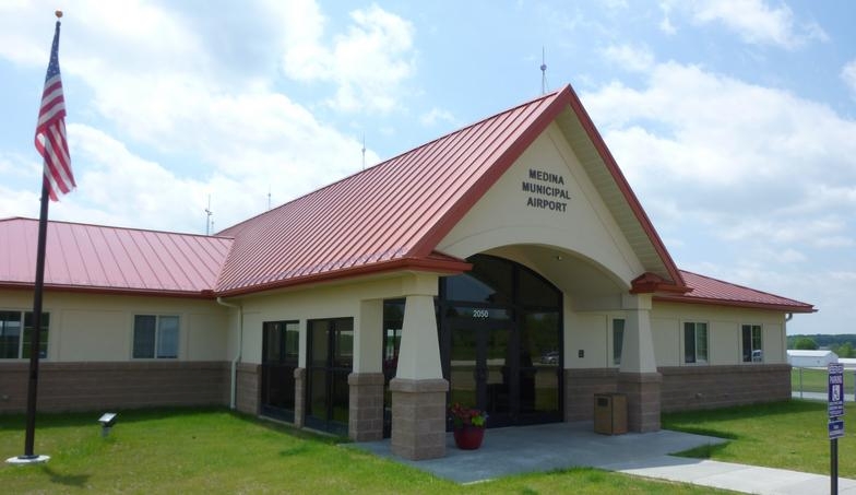
Medina Municipal Airport
Welcome to Medina Municipal Airport.
Airport Ownership and Management from official FAA records
| Ownership: | Publicly-owned |
| Owner: | CITY OF MEDINA PO BOX 703 MEDINA, OH 44258-0703 Phone 330-725-8861 |
| Manager: | GREG HUBER PO BOX 703 MEDINA, OH 44258-0703 Phone 330-239-1606 |
For link to Airport Operator (FBO)
Cold Stream Air Service, click HERE
FlightAware
As the leader in providing advanced, accurate, actionable data and insights that inform every aviation decision, FlightAware is Central to Aviation
FLIGHT TRACKER Flight Tracker
Location
| FAA Identifier: | 1G5 |
| Lat/Long: | 41-07-53.2000N 081-45-53.6000W 41-07.886667N 081-45.893333W 41.1314444,-81.7648889 (estimated) |
| Elevation: | 1189.8 ft. / 362.7 m (surveyed) |
| Variation: | 07W (1990) |
| From city: | 4 miles E of MEDINA, OH |
| Time zone: | UTC -5 (UTC -4 during Daylight Saving Time) |
| Zip code: | 44256 |
Airport Operations
| Airport use: | Open to the public |
| Control tower: | no |
| ARTCC: | CLEVELAND CENTER |
| FSS: | CLEVELAND FLIGHT SERVICE STATION |
| NOTAMs facility: | CLE (NOTAM-D service available) |
| Attendance: | APR-OCT 0800-2000, NOV-MAR 0800-1700 |
| Wind indicator: | lighted |
| Segmented circle: | yes |
| Lights: | ACTVT REIL RWY 27; PAPI RWY 01, 19, & 27; MIRL RWY 01/19 & 09/27 - CTAF. PAPI RWY 01, 19, & 27 OPR CONSLY DUSK-2200. |
| Beacon: | white-green (lighted land airport) Operates sunset to sunrise. |
Airport Communications
| CTAF/UNICOM: | 123.0 |
| CLEVELAND APPROACH: | 125.35 |
| CLEVELAND DEPARTURE: | 125.35 |
| WX ASOS at AKR (15 nm SE): | 126.825 (330-724-4237) |
| WX AWOS-2 at 1G3 (16 nm E): | 119.15 (330-346-1497) |
| WX ASOS at BJJ (16 nm S): | 118.075 (330-669-9105) |
| WX ASOS at CLE (17 nm N): | PHONE 216-416-2729 |
| WX ASOS at CAK (19 nm SE): | PHONE 330-493-5260 |
Nearby radio navigation aids
| VOR radial/distance | VOR name | Freq | Var | |||
|---|---|---|---|---|---|---|
| DJBr132/22.5 | DRYER VOR/DME | 113.60 | 05W | |||
| ACOr277/25.5 | AKRON VOR/DME | 114.40 | 04W | |||
| BSVr331/27.9 | BRIGGS VOR/DME | 112.40 | 04W | |||
| CXRr235/35.6 | CHARDON VOR/DME | 112.70 |
05W |
Airport Services
| Fuel available: | 100LL JET-A+ 100LL:AVBL H24 SELF SER. |
| Parking: | hangars and tiedowns |
| Airframe service: | MAJOR |
| Powerplant service: | MAJOR |
Runway Information
Runway 9/27
| Dimensions: | 3556 x 75 ft. / 1084 x 23 m | ||||
| Surface: | asphalt, in good condition | ||||
| Weight bearing capacity: |
|
||||
| Runway edge lights: | medium intensity | ||||
| RUNWAY 9 | RUNWAY 27 | ||||
| Latitude: | 41-07.881618N | 41-07.946467N | |||
| Longitude: | 081-46.425062W | 081-45.655383W | |||
| Elevation: | 1168.8 ft. | 1182.8 ft. | |||
| Traffic pattern: | left | left | |||
| Runway heading: | 091 magnetic, 084 true | 271 magnetic, 264 true | |||
| Markings: | nonprecision, in good condition | nonprecision, in good condition | |||
| Visual slope indicator: | 4-light PAPI on left (3.00 degrees glide path) U/S INDEFLY. |
4-light PAPI on left (3.50 degrees glide path) | |||
| Runway end identifier lights: | yes | ||||
| Touchdown point: | yes, no lights | yes, no lights | |||
| Obstructions: | 20 ft. tree, 478 ft. from runway, 36 ft. right of centerline, 13:1 slope to clear +4-6 FT BRUSH, 100-200 FT DIST, 180-200 FT R. |
none | |||
Runway 1/19
| Dimensions: | 2868 x 60 ft. / 874 x 18 m | ||||
| Surface: | asphalt, in fair condition | ||||
| Weight bearing capacity: |
|
||||
| Runway edge lights: | medium intensity | ||||
| RUNWAY 1 | RUNWAY 19 | ||||
| Latitude: | 41-07.616738N | 41-08.088963N | |||
| Longitude: | 081-45.718333W | 081-45.707340W | |||
| Elevation: | 1170.1 ft. | 1189.8 ft. | |||
| Traffic pattern: | left | left | |||
| Runway heading: | 008 magnetic, 001 true | 188 magnetic, 181 true | |||
| Displaced threshold: | no | 737 ft. | |||
| Markings: | basic, in good condition | basic, in good condition | |||
| Visual slope indicator: | 4-light PAPI on left (3.00 degrees glide path) | 4-light PAPI on left (4.00 degrees glide path) | |||
| Touchdown point: | yes, no lights | yes, no lights | |||
| Obstructions: | 15 ft. pline, marked, 450 ft. from runway, 16:1 slope to clear | 71 ft. trees, 610 ft. from runway, 175 ft. left of centerline, 5:1 slope to clear APCH SLP 16:1 DUE TO +71 FT TREE, 1347 FT FM DTHR. |
|||
Airport Operational Statistics
|
|
|||||||||||||||||||||||||||
Additional Remarks
| - | DEER, BIRDS, & OTR WILDLIFE ON & INVOF ARPT. |
| - | FOR CD CTC CLEVELAND APCH AT 216-352-2323. |
| - | NOISE-SENSITIVE RES & LIVESTOCK AREA INVOF ARPT, DEPS RCMDD TO FLY RWY HDG TIL RCHG TPA. |
Instrument Procedures
NOTE: All procedures below are presented as PDF files. If you need a reader for these files, you should download the free Adobe Reader.
NOT FOR NAVIGATION. Please procure official charts for flight.
FAA instrument procedures published for use from 26 January 2023 at 0901Z to 23 February 2023 at 0900z.
| IAPs - Instrument Approach Procedures |
||
|---|---|---|
| RNAV (GPS) RWY 09 **CHANGED** | download | |
| RNAV (GPS) RWY 27 **CHANGED** | download | |
| VOR RWY 27 **CHANGED** | download | |
| NOTE: Special Take-Off Minimums/Departure Procedures apply | download (164KB) | |
Other nearby airports with instrument procedures:
3G3 - Wadsworth Municipal Airport (8 nm S)
KAKR - Akron Fulton International Airport (15 nm SE)
1G3 - Kent State University Airport (16 nm E)
KBJJ - Wayne County Airport (16 nm S)
KCLE - Cleveland-Hopkins International Airport (17 nm N)
1G1 - Elyria Airport (19 nm NW)
KCAK - Akron-Canton Regional Airport (19 nm SE)